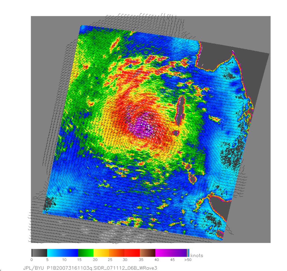
Tropical Cyclone Sidr crept steadily north and west over the warm waters of the Bay of Bengal after forming on November 11, 2007. This image shows the storm as observed by NASA's winds.jpl.nasa.gov/missions/quikscat/index.cfm QuikSCAT satellite on November 11, 2007. At the time, the center of the developing storm sat west of the southern edge of the Andaman Islands. The colors chart out the storm's wind speed, and not surprisingly, the strongest winds are in the center of the storm. Small barbs show wind direction, and white barbs point to heavy rainfall. On November 12, the https://metocph.nmci.navy.mil/jtwc.php Joint Typhoon Warning Center forecast that Sidr would grow to the equivalent of a Category 2 storm, with sustained winds of 170 kilometers/hour (100 mph or 90 knots) by November 14.
NASA image courtesy of David Long, Brigham Young University, on the winds.jpl.nasa.gov/ QuikSCAT Science Team, and the Jet Propulsion Laboratory.
| Date Taken: | 08.02.2011 |
| Date Posted: | 10.10.2012 12:11 |
| Photo ID: | 689539 |
| Resolution: | 1820x1720 |
| Size: | 2.17 MB |
| Location: | WASHINGTON, DISTRICT OF COLUMBIA, US |
| Web Views: | 5 |
| Downloads: | 0 |
