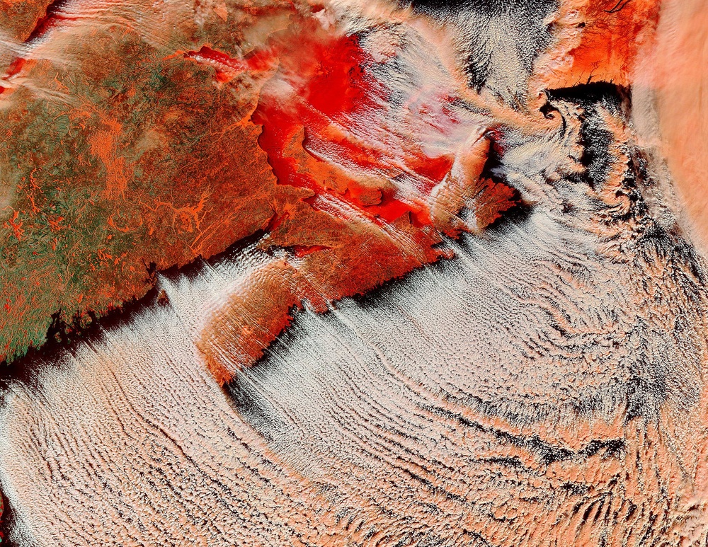
Cold, dry arctic air swept down over Canada, bringing chilling temperatures to much of the country. As the cold air moved out over the Atlantic Ocean, it met warmer, moist air, and clouds formed. The clouds are thin near the coast, and thicken as the air picks up more moisture over the ocean. The ice in the clouds tint them a light orange in this false-color modis.gsfc.nasa.gov Moderate Resolution Imaging Spectroradiometer (MODIS) image.
Since visible light is assigned to red in this false-color image, ice appears dark red and water is black. Red over the Gulf of St. Lawrence, top center, and the St. Lawrence River, upper left, attests that both are covered in a layer of ice. The ice has caused problems upstream, beyond the left corner of this image. Ice jams in the Riviere des Prairies, a tributary of the St. Lawrence River, have dammed the river, causing flooding in Montreal and Laval.
The terra.nasa.gov/ Terra satellite acquired this image on January 25, 2004. The high-resolution image provided above has a resolution 500 meters per pixel. The image is available in rapidfire.sci.gsfc.nasa.gov/gallery/?2004025-0125/NovaScotia.A2004025.1500.367'' target =''outlink additional resolutions , including MODIS' maximum resolution of 250 meters per pixel.
Image courtesy Jacques Descloitres, rapidfire.sci.gsfc.nasa.gov MODIS Rapid Response Team at NASA GSFC
| Date Taken: | 07.24.2011 |
| Date Posted: | 10.10.2012 15:06 |
| Photo ID: | 702479 |
| Resolution: | 2200x1700 |
| Size: | 2.61 MB |
| Location: | WASHINGTON, DISTRICT OF COLUMBIA, US |
| Web Views: | 15 |
| Downloads: | 2 |
