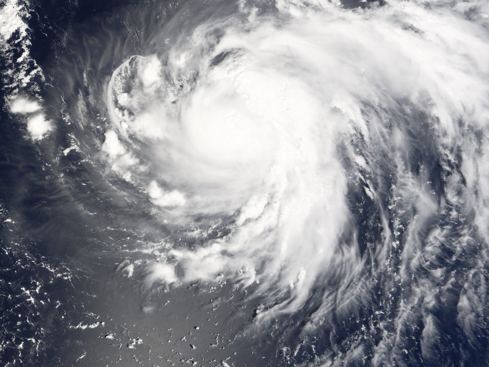
Typhoon Shanshan formed on September 10, 2006, in the western Pacific well off the coast of the Philippine Islands. Over the course of the next 36 hours, it grew from a tropical depression (area of low air pressure) to a typhoon. As of September 11, it was projected to travel northwest but to veer off before reaching the Asian mainland. The storm was predicted to turn towards the northeast and move parallel to the southern islands of the Japan. It was not predicted to come ashore or strike any major urban centers.
This photo-like image was acquired by the Moderate Resolution Imaging Spectroradiometer modis.gsfc.nasa.gov/ (MODIS) on the aqua.nasa.gov/ Aqua satellite on September 11, 2006, at 2:50 p.m. local time (05:50 UTC). Shanshan at the time of this image was a large, spiraling swirl, still in the early stages of becoming a powerful, organized storm. As the Aqua satellite passed overhead, Shanshan was still a tropical storm. Shanshan had sustained winds of around 110 kilometers per hour (70 miles per hour) at the time this satellite image was acquired, according to the University of Hawaii's www.solar.ifa.hawaii.edu/Tropical/tropical.html Tropical Storm Information Center.
NASA image created by Jesse Allen, Earth Observatory, using data provided courtesy of the rapidfire.sci.gsfc.nasa.gov/ MODIS Rapid Response team.
| Date Taken: | 07.31.2011 |
| Date Posted: | 10.10.2012 16:05 |
| Photo ID: | 706991 |
| Resolution: | 5400x4050 |
| Size: | 5.21 MB |
| Location: | WASHINGTON, DISTRICT OF COLUMBIA, US |
| Web Views: | 5 |
| Downloads: | 2 |
