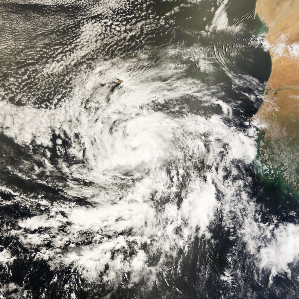
On July 3, a tropical wave (a migratory, wavelike disturbance of the tropical easterlies) off the western coast of Africa strengthened into a circular pattern of intensifying clouds, forming Tropical Storm Bertha. This natural-color image, obtained by the Moderate Resolution Imaging Spectroradiometer ( modis.gsfc.nasa.gov MODIS ) on NASA's terra.nasa.gov/ Terra satellite shows Bertha in its early stages, south of the Cape Verde Islands. Storms that form in this region are known as Cape Verde storms, and they typically are first observed forming in August or September, though a Cape Verde storm as early as July is not particularly unusual.
The storm system shows the nascent spiraling shape of a developing cyclone. Within days, Tropical Storm Bertha was halfway across the Atlantic Ocean, intensifying to become a hurricane as it traveled over warm ocean waters. According to the www.nhc.noaa.gov/ National Hurricane Center, as of July 8, Bertha was a www.nhc.noaa.gov/aboutsshs.shtml Category 2 strength hurricane, having peaked earlier at Category 3. Forecasts at that time showed Bertha arcing northward towards Bermuda, though forecasters were not expecting the hurricane to directly cross the island.
Bertha was the first hurricane of the 2008 Atlantic storm season. Usually, the first hurricane of a season forms by mid-August; in 2007, the first hurricane was Dean, which formed on August 16. However, it is not unprecedented to have a first hurricane this early in the season. In 1996, another storm formed to become a hurricane on July 7. It, too, was named Bertha. Unless they are retired, storm names are reused every six years.
NASA image created by Jesse Allen, using data provided courtesy of the rapidfire.sci.gsfc.nasa.gov/ MODIS Rapid Response team. Caption by Jesse Allen.
| Date Taken: | 08.07.2011 |
| Date Posted: | 10.19.2012 15:33 |
| Photo ID: | 751477 |
| Resolution: | 8000x8000 |
| Size: | 7.43 MB |
| Location: | WASHINGTON, DISTRICT OF COLUMBIA, US |
| Web Views: | 54 |
| Downloads: | 3 |
