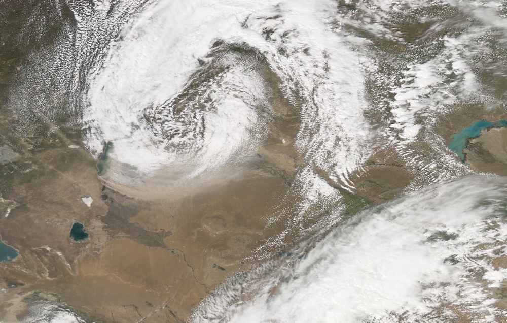
A massive dust storm blew through central Asia on May 7, 2007. The Moderate Resolution Imaging Spectroradiometer modis.gsfc.nasa.gov (MODIS) on NASA's aqua.nasa.gov Aqua satellite took this picture the same day, capturing the dust sweeping in a counterclockwise direction east of the Aral Sea. In this image, the dust appears as a pale beige swath immediately south of a large bank of clouds. The dust mimics the movement of the clouds, and both clouds and dust may have resulted from the same weather system.
Although a few plumes originate to the west, most of the dust plumes originate along the shores of the South Aral Sea. The dry lake beds surrounding the South Aral Sea provide ample material for dust storms. The sea began earthobservatory.nasa.gov/Newsroom/NewImages/images.php3?img_id=4819 retreating in the 1960s. Although the North Aral Sea had earthobservatory.nasa.gov/Newsroom/NewImages/images.php3?img_id=17634 rebounded somewhat by the spring of 2007, thanks to conservation efforts, the southern portion of this massive lake continued to decline.
You can download a eoimages.gsfc.nasa.gov/images/imagerecords/18000/18344/centralasia_amo_2007127.kmz 250-meter-resolution Central Asia KMZ file for use with earth.google.com/download-earth.html Google Earth.
NASA image created by Jesse Allen, using data provided courtesy of the rapidfire.sci.gsfc.nasa.gov/ MODIS Rapid Response team.
| Date Taken: | 08.01.2011 |
| Date Posted: | 10.19.2012 15:48 |
| Photo ID: | 752310 |
| Resolution: | 9784x6224 |
| Size: | 6.63 MB |
| Location: | WASHINGTON, DISTRICT OF COLUMBIA, US |
| Web Views: | 5 |
| Downloads: | 1 |
