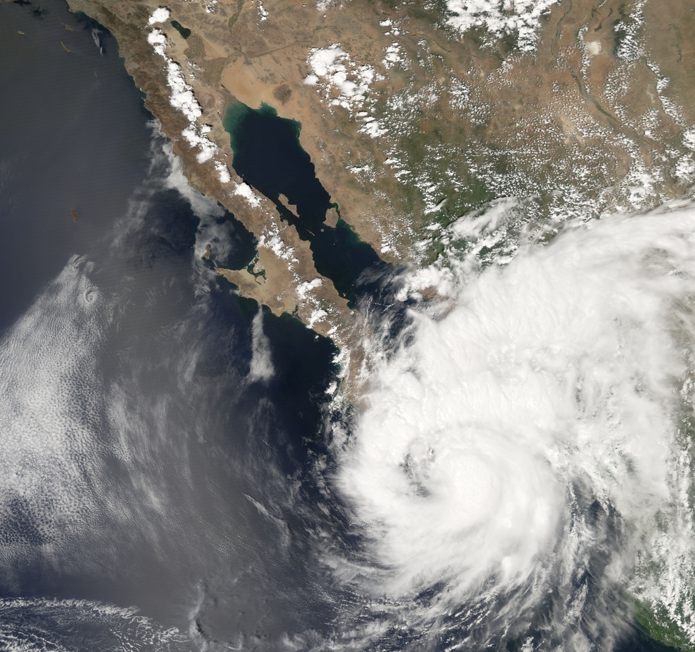
The eastern Pacific hurricane season had been relatively quiet when Hurricane Henriette formed in late August of 2007. Henriette traveled offshore from the Mexican Pacific coast from August 30 to September 4, gradually becoming a www.nhc.noaa.gov/aboutsshs.shtml Category 1 hurricane. The storm had just come ashore over Cabo San Lucas, Baja California, when the Moderate Resolution Imaging Spectroradiometer ( modis.gsfc.nasa.gov MODIS ) on NASA's aqua.nasa.gov/ Aqua satellite acquired this photo-like image at 1:55 p.m. local time (20:55 UTC) on September 4, 2007.
Just a few hours before MODIS observed the storm, the National Hurricane Center estimated Henriette's sustained winds to be over 110 kilometers per hour (75 miles per hour), consistent with their Category 1 prediction. The satellite image shows Henriette to have only a loosely wound spiral arm structure and only traces of a central eye. This is consistent with a low-strength hurricane.
You can download a eoimages.gsfc.nasa.gov/images/imagerecords/18000/18993/henriette_amo_2007247.kmz 250-meter-resolution KMZ file of Hurricane Henriette suitable for use with earth.google.com/ Google Earth.
NASA image created by Jesse Allen, using data provided courtesy of the rapidfire.sci.gsfc.nasa.gov/ MODIS Rapid Response team.
| Date Taken: | 08.02.2011 |
| Date Posted: | 10.19.2012 16:14 |
| Photo ID: | 753685 |
| Resolution: | 7116x6672 |
| Size: | 6.64 MB |
| Location: | WASHINGTON, DISTRICT OF COLUMBIA, US |
| Web Views: | 3 |
| Downloads: | 0 |
