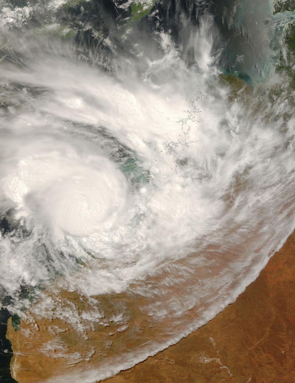
After crossing Australia's Northern Territory and triggering earthobservatory.nasa.gov/NaturalHazards/natural_hazards_v2.php3?img_id=14159 floods , Cyclone George skimmed along the Australian coast, steadily gaining power. By the time the storm took a sharp turn towards shore and headed towards Port Hedland in northern Western Australia on March 8, 2007, the cyclone packed sustained winds of 200 kilometers per hour (127 miles per hour, 110 knots), with gusts to 250 km/hr (155 mph, 135 knots). The Moderate Resolution Imaging Spectroradiometer ( modis.gsfc.nasa.gov MODIS ) on NASA's terra.nasa.gov/ Terra satellite captured this image on March 8 at 10:55 a.m. local time (1:55 UTC). Though the storm lacks a distinct eye, the dense concentration of swirling clouds attests to the storm's power.
The high-resolution image provided above is at MODIS' full spatial resolution (level of detail) of 250 meters per pixel. The MODIS Rapid Response System provides this image at rapidfire.sci.gsfc.nasa.gov/gallery/?2007067-0308/George.A2007067.0155 additional resolutions.
You can also download a eoimages.gsfc.nasa.gov/images/imagerecords/18000/18086/George.A2007067.0155.250m.kmz 250-meter-resolution Cyclone George KMZ file for use with earth.google.com/download-earth.html Google Earth.
NASA image by Jeff Schmaltz, rapidfire.sci.gsfc.nasa.gov MODIS Rapid Response Team, Goddard Space Flight Center.
| Date Taken: | 08.01.2011 |
| Date Posted: | 02.08.2013 01:54 |
| Photo ID: | 831418 |
| Resolution: | 6000x7800 |
| Size: | 3.37 MB |
| Location: | WASHINGTON, D.C., US |
| Web Views: | 3 |
| Downloads: | 1 |
