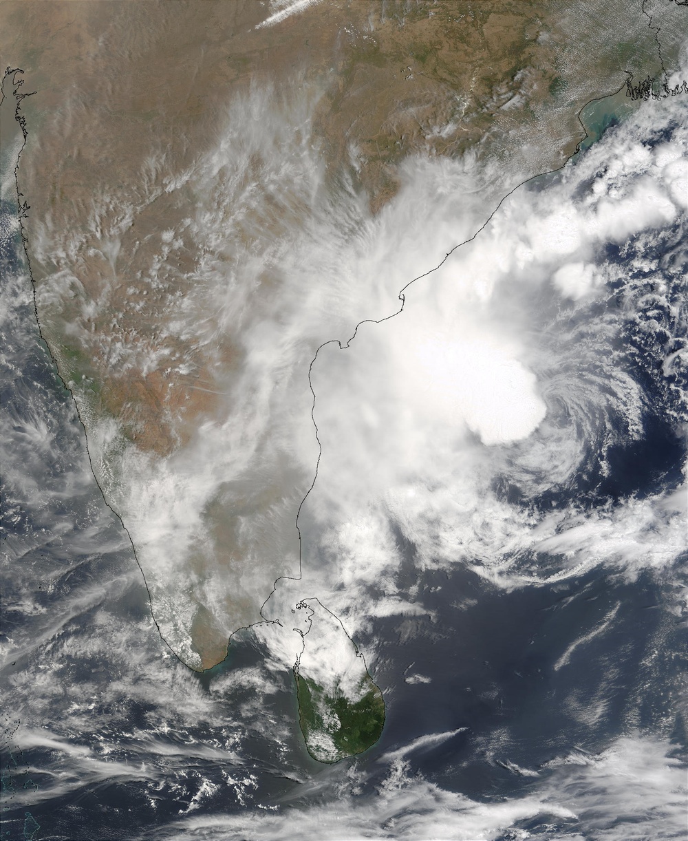
On May 14, 2003, the MODIS instrument onboard the NASA's Terra satellite captured this bird's-eye view of Tropical Cyclone 01B in the Bay of Bengal. This satellite image reveals that the low-level circulation is fully exposed to the east of the deep convection (dense cloud).
The high-resolution image provided above is 500 meters per pixel. The MODIS Rapid Response System provides this image at MODIS' maximum spatial resolution of rapidfire.sci.gsfc.nasa.gov/gallery/?2003134-0514 250 meters.
Image courtesy Jeff Schmaltz, rapidfire.sci.gsfc.nasa.gov MODIS Rapid Response Team, NASA GSFC
| Date Taken: | 07.23.2011 |
| Date Posted: | 02.08.2013 20:08 |
| Photo ID: | 857780 |
| Resolution: | 1800x2200 |
| Size: | 643.9 KB |
| Location: | WASHINGTON, D.C., US |
| Web Views: | 1 |
| Downloads: | 1 |
