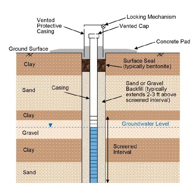
A piezometer is a geotechnical instrument that measures changes of water level or water pressure beneath the surface. There are 25 piezometers specifically arranged at Lucky Peak Dam to gather risk assessment data for engineers. The piezometers extend to different lengths beneath the surface to measure water depth at specific locations.
| Date Taken: | 07.24.2023 |
| Date Posted: | 08.03.2023 13:56 |
| Photo ID: | 7950643 |
| VIRIN: | 230724-A-LQ420-5114 |
| Resolution: | 669x638 |
| Size: | 95.21 KB |
| Location: | BOISE, IDAHO, US |
| Web Views: | 176 |
| Downloads: | 2 |

This work, Piezometer [Image 2 of 2], by Noe Gonzalez, identified by DVIDS, must comply with the restrictions shown on https://www.dvidshub.net/about/copyright.