170825-N-N0101-501
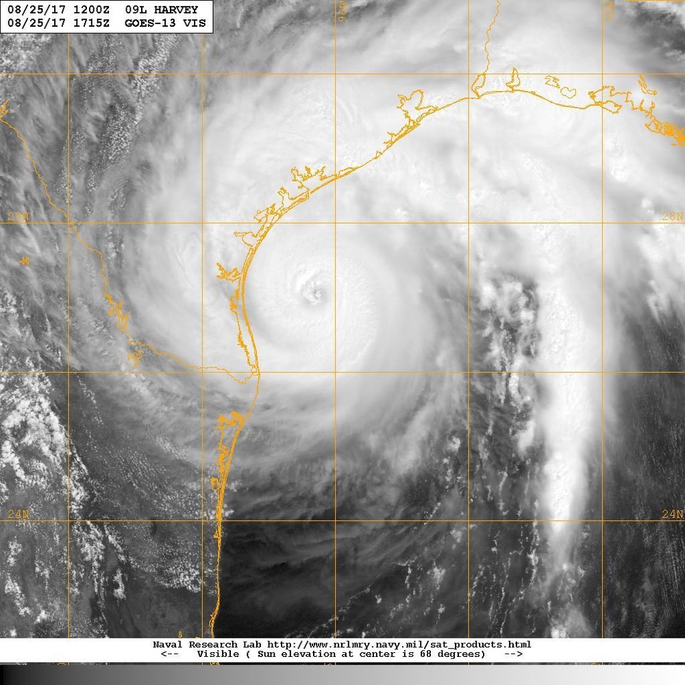
GULF OF MEXICO (Aug. 25, 2017) An infrared satellite image of Hurricane Harvey, a category 2 hurricane on the Saffir-Simpson wind scale. Harvey is moving toward the northwest near 10 mph (17 km/h), but its forward speed is expected to decrease significantly during the next couple of days. On the forecast track, Harvey will make landfall on the middle Texas coast tonight or early Saturday. Harvey is then likely to meander near or just inland of the middle Texas coast through the weekend. Maximum sustained winds are near 110 mph (175 km/h) with higher gusts. Some strengthening is possible, and Harvey is forecast to become a major hurricane before it reaches the middle Texas coast. Hurricane-force winds extend outward up to 35 miles (55 km) from the center, and tropical-storm-force winds extend outward up to 140 miles (220 km). A buoy located about 40 miles east of South Padre Island recently reported sustained winds of 42 mph (68 km/h) and a gust to 54 mph (86 km/h). The minimum central pressure based on data from the Air Force plane is 947 mb (27.97 inches). (U.S. Navy photo/Released)
| Date Taken: | 08.25.2017 |
| Date Posted: | 08.29.2017 00:58 |
| Photo ID: | 3714904 |
| VIRIN: | 170825-N-N0101-501 |
| Resolution: | 1024x1024 |
| Size: | 182.99 KB |
| Location: |
| Web Views: | 34 |
| Downloads: | 10 |

This work, 170825-N-N0101-501 [Image 221 of 221], must comply with the restrictions shown on https://www.dvidshub.net/about/copyright.